Somehow I live only a couple of hours away from Beidawushan but I have never hiked it yet. I guess I still officially haven’t but that’s another story for later in this blog. Beidawushan is the southernmost of Taiwan’s Baiyue (top 100 peaks) and it is spectacular. Overall there are 358 peaks taller than 3000 meters (9850 feet) but 40-50 years ago a group selected the top 100 mountains (several criteria) from that list and called them the Baiyue. Some of the Baiyue are easy hikes (like Hehuanshan) and some are grueling 3-5 day treks (possibly even longer). Beidawushan is a reasonably difficult 3 day (or very difficult 2 day) trip and is only a few hours drive from Kaohsiung. I have wanted to hike Beidawushan for a long time but I always put it off. Had I known how spectacular the trail was I wouldn’t have waited so long.
My hiking guide for Beidawushan
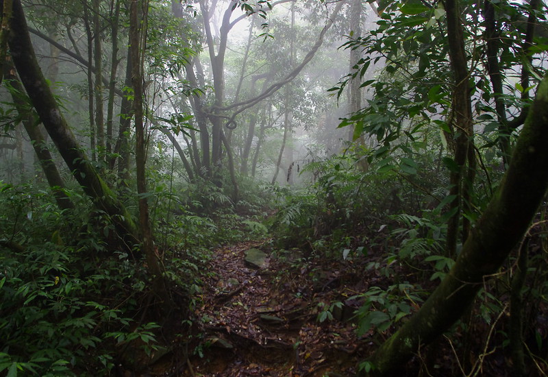
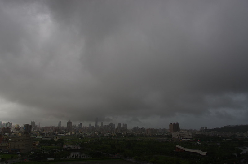
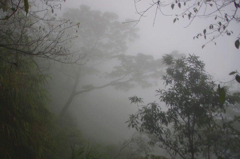
Despite Taiwan being in a 7+ month long drought (seasonal but worse this year) and the reservoirs emptying to the point that rolling water outages were happening it was raining on our trip. This was almost the only place in Taiwan that got any rain that weekend. It is inconvenient to hike in the rain but it is awesome to take photos in between rain showers.
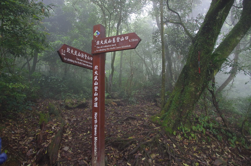
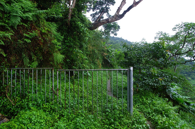
Beidawushan was another casualty of the much written about Typhoon Morakot. I moved to Taiwan shortly after one of the worst typhoons in Taiwan history and during the last 5 years I have seen all kinds of damage that in some cases still isn’t repaired. At Beidawushan the typhoon caused a massive landslide that will never be repaired across the access road. They have built a new trail to the old trailhead and the hike is now 2.8kms longer. This really isn’t a bad thing since the new trail is spectacular and the first day was already a short hike to the Kauigu Cabin. Unfortunately they haven’t built a new parking lot yet and it might not be possible given the geography. Cars now parallel park along a narrow mountain road at the trailhead and it isn’t rare that a car will have to back down the road 50 meters because there isn’t any room to turn around on a weekend.
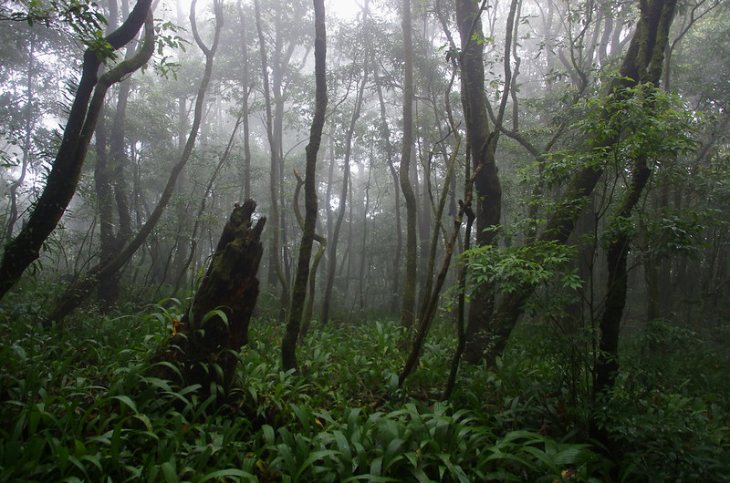
The rest of Taiwan might have been bone dry from the drought but Taiwan’s mountains have different micro climates and stay lush year round. Our trip alternated between light rain, no rain and heavy rain. It didn’t really affect my trip but it is obvious that I need to upgrade my rain protection system. I’m currently considering adding a Packa rainponcho that doubles as a packcover and in theory ventilates better while keeping your pack really dry.
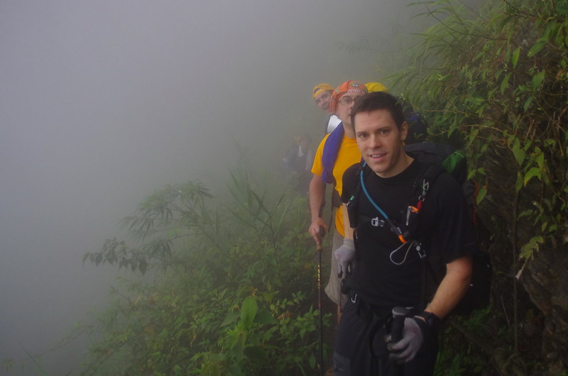
5 of us left Kaohsiung early Saturday morning. Alastair, Wolfgang and Joshua were photobombed by a ghostly Taiwanese hiker coming out of the mist.
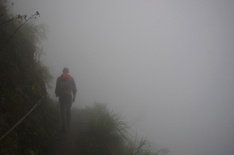
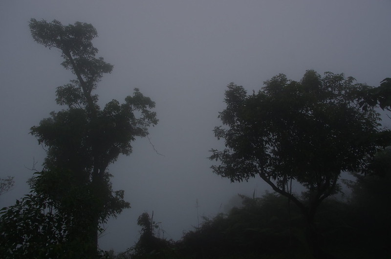
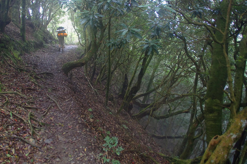
Nick walks into the abyss.

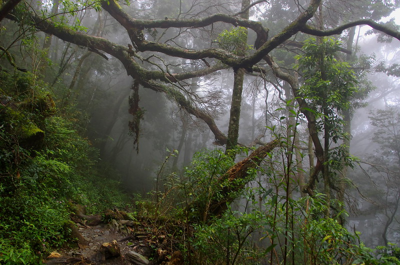
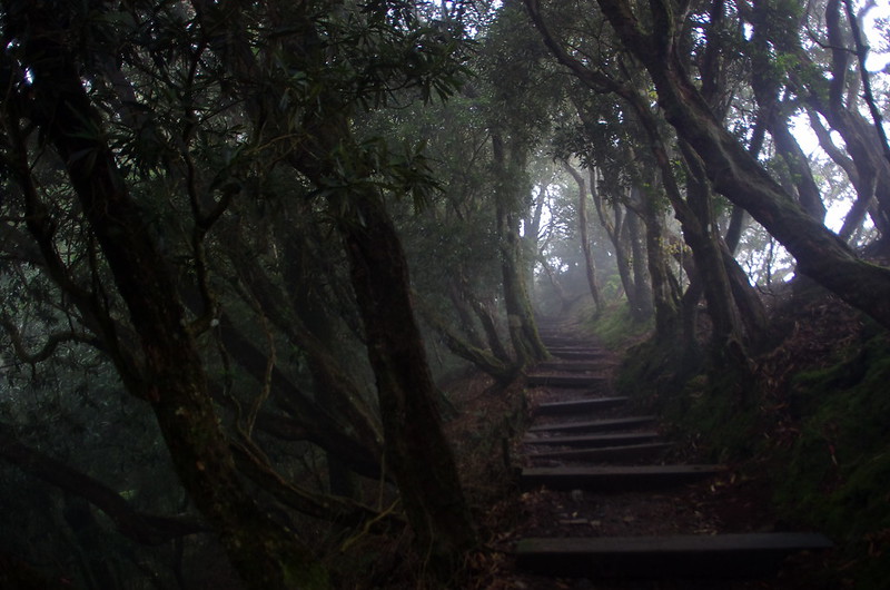
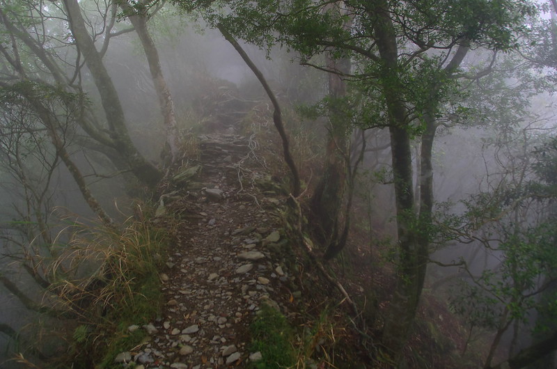
The access road might have been destroyed but overall the trail is in really good shape. It is a natural dirt and rock trail and there are many sections where hikers need to scramble up or down rocks but the provided ropes make it relatively easy. I say relatively because the overall pace of the hike is between 1 and 1.5 kms/hr. That is partly due to the 1900 meters of elevation gain over 12 kilometers and partly due to rock obstacles on trail. It isn’t an easy hike but I love hiking these kind of trails because there is a trend in Taiwan to overbuild trails with boardwalks or concrete.
My hiking guide to Beidawushan
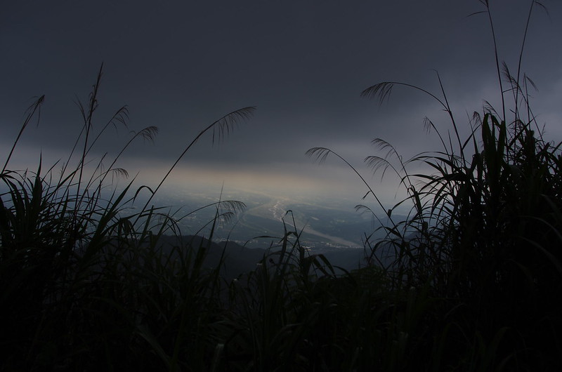
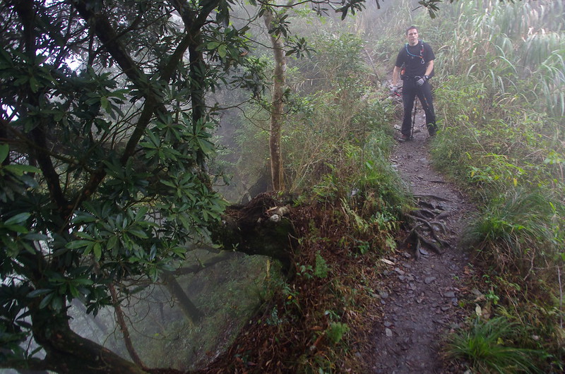
One of the best parts of the trail is a narrow ridgeline that is within a very cool part of the forest. This area must be prone to some awful winds and weather. The trees were rather short and crookedly bent. In some places the ridge is less than a meter wide and sharply drops away on both sides.

Kuaigu Mountain Cabin is a basic bunkhouse that offers all of the amenities (but nothing extra) that a hiker could want. There is only one room and just outside there is a long counter for cooking. One unique thing about Taiwanese camping groups is that they like to cook up elaborate meals in the mountains even if they are carrying all of the food and gear for many hours. On a different hike one group carried an entire chicken and went through the long rotisserie process over an open fire. It was interesting to watch but it would frustrate me after a long day of hiking. Most foreigners seem to prefer survival food consisting of packets of noodles. I’m a little more ambitious with my cooking and volunteered to cook for the group. We enjoyed pasta (gluten free for me), fresh mini corn, green beans and garlic with canned chicken (Costco), olive oil, basil and seasoned salt. It’s pretty awesome and not that hard if you know how to boil water.
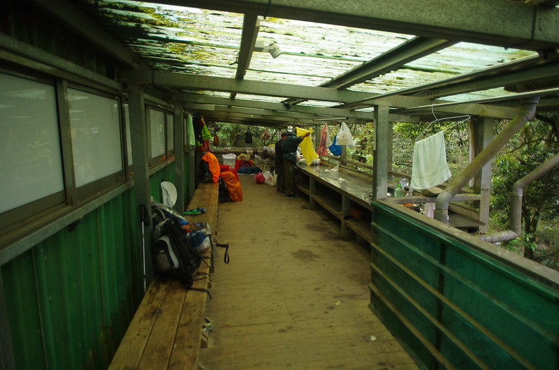
The cook station in the morning.
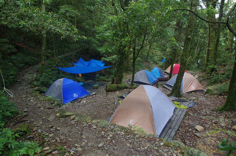
There is only room for 40-50 people in the cabin but there about 30 tent platforms that are available on a first come basis. We arrived around 4pm on a Saturday and got some of the last tent platforms downwind of the bathrooms. Ironically we were camped next to the other foreigner group that weekend. A pair of fathers brought their teen/preteen sons on a 3 day trip.
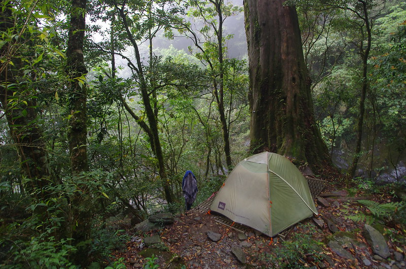
My REI quarterdome tent still performs quite well after 6+ years and dozens of trips.
I ultimately chose not to hike to the summit the second day and instead stayed in camp. I have described the hike options on my Beidawushan guide but the 2 day option that we did requires a 12-14 hour hiking day. That might have been possible but I had a lot of work to do that week starting immediately on Monday and I really wanted to also go on the Alanyi/Qufengbi trip the next weekend. Most likely I would have been completely exhausted and stayed home that weekend if I had hiked to the summit so I will have to return sometime for the rest of the hike. Overall I loved the shortened version of my hike and don’t regret at all not hiking to the summit. The trail is absolutely amazing and I missed the best part.
My hiking guide to Beidawushan

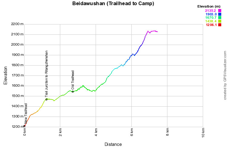
This is just the ascent to the camp. The summit is another 1000 meters up in less than 5 kms of hiking.
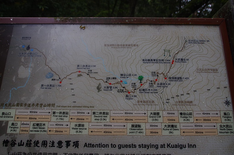
An even better map than mine. I still have a lot to learn about map making.